

Click on the thumbnails above to see views of this map, or
click here for a zoomable view.
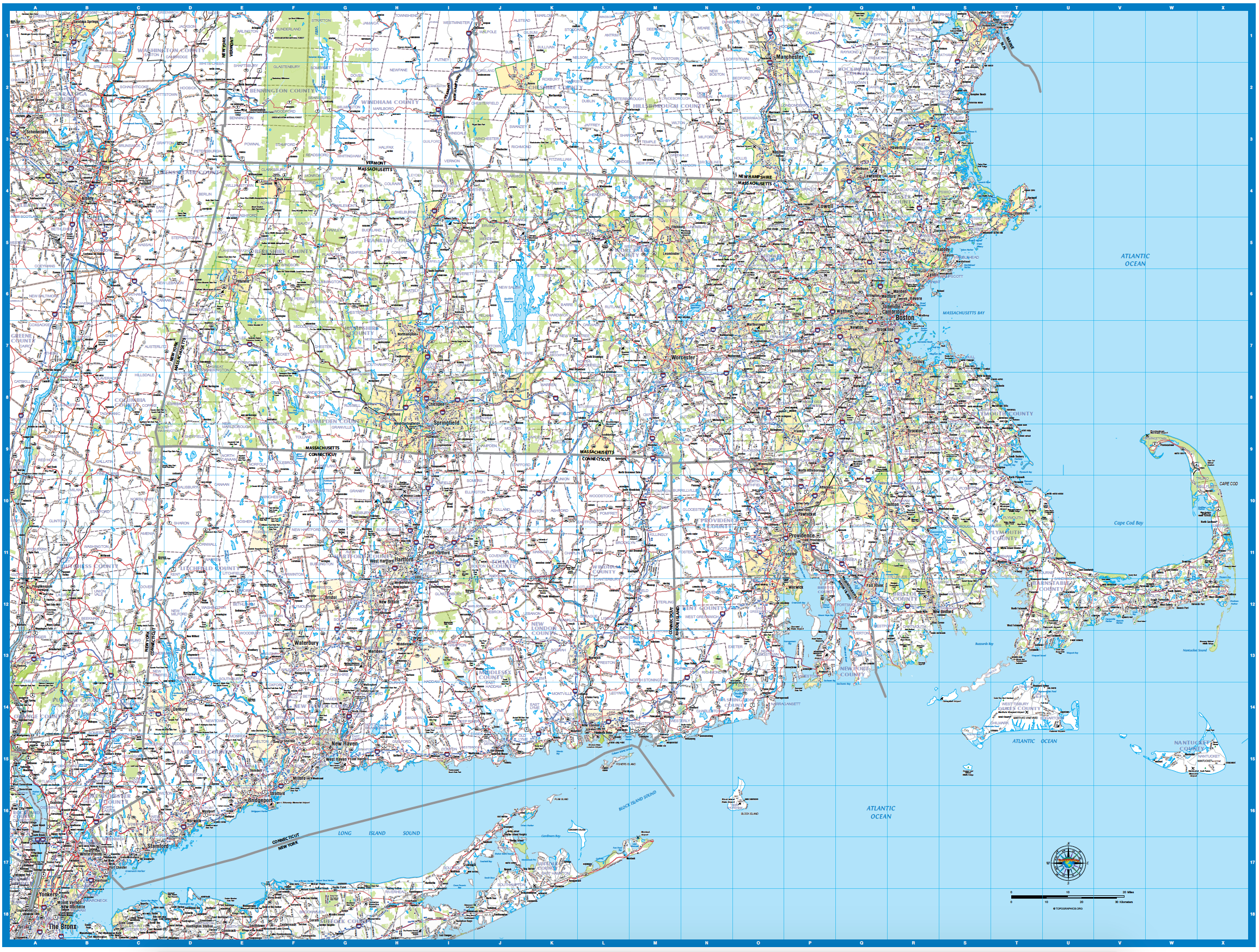
The Southern New England Laminated Wall Map shows states, counties, cities, towns, hamlets, major points of interest, and major and secondary highways for Massachusetts, Connecticut, Rhode Island, and adjacent areas of Vermont, New Hampshire, and New York.
This highly detailed map comes with a plastic lamination. Information shown on the map has been recently updated. The map is rolled and shipped in a sturdy tube.
The map is the perfect tool for viewing the whole region at a glance, and can be used to show sales territories, marketing initiatives, customer locations, or as a visual resource to better understand Southern New England.
FREE SHIPPING!
Southern New England Laminated Wall Map
$205.00Price