

Click on the thumbnails above to see views of this map, or
click here for a zoomable view.
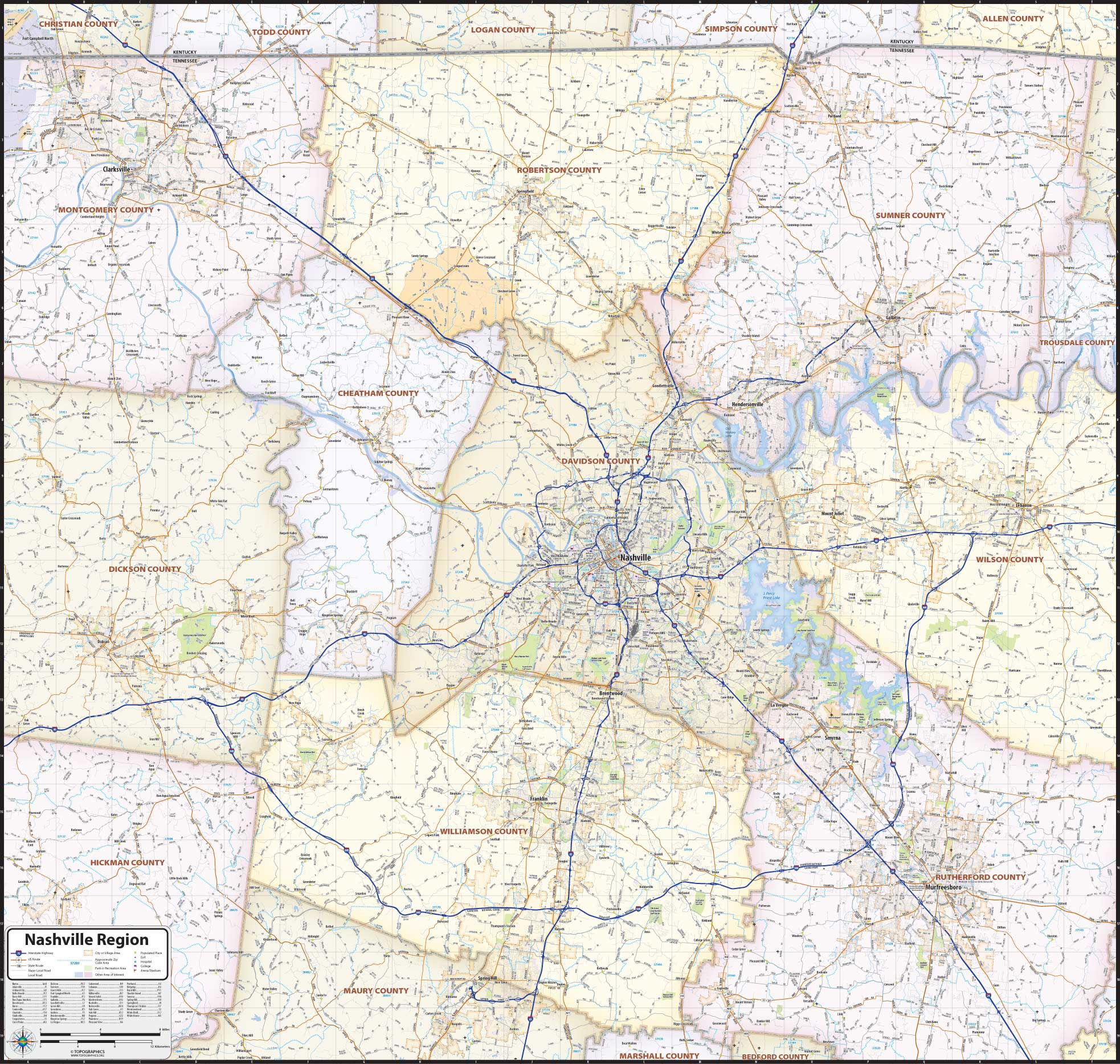
Our laminated Nashville Region Map highlights the area within a 70 mile wide by 70 mile high region of middle Tennessee, centered on Nashville and Davidson County. The map extends from Clarksville in the northwest to Murfreesboro in the southeast, and from the Kentucky/Tennessee state line in the north to Spring Hill in the south. The perfect tool for visualizing the big picture for the entire Nashville Metro area, the map shows counties, cities, towns, and major and secondary roads. The map is printed on heavyweight paper with a dry-erase lamination that allows the use of write-on/wipe-off dry-erase markers.
This map comes in a variety of sizes and has a laminated coating. It is shipped rolled in a sturdy tube.
Please view the images to see the detail and coverage area of this map.